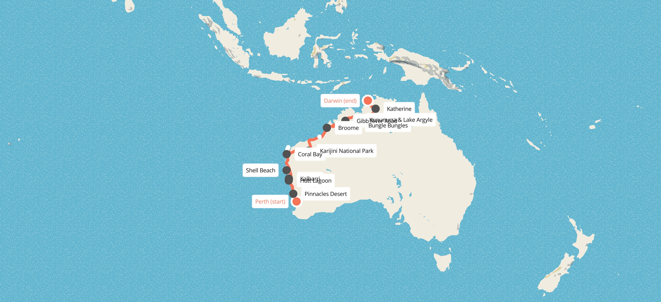
Map
DAY 1: PERTH TO KALBARRI
The trip starts in Perth and heads north up the coast. In Nambung National Park the Pinnacles rise out of yellow sand by the thousand, limestone pillars up to 3.5 metres tall, formed over tens of thousands of years from seashells broken down and cemented by rain. Further on, the road passes through Geraldton, the port nearest the Abrolhos Islands, where the Dutch ship Batavia was wrecked in 1629. At Port Gregory, Hutt Lagoon is coloured pink by an alga, Dunaliella salina, that makes beta-carotene, and the shade shifts from bubblegum to lilac with the time of day and the cloud. Then it's on to the river-mouth town of Kalbarri for the night.
Overnight: Kalbarri (hostel)
DAY 2: KALBARRI NATIONAL PARK TO SHARK BAY
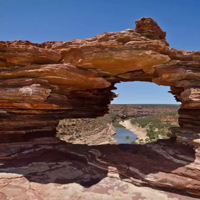
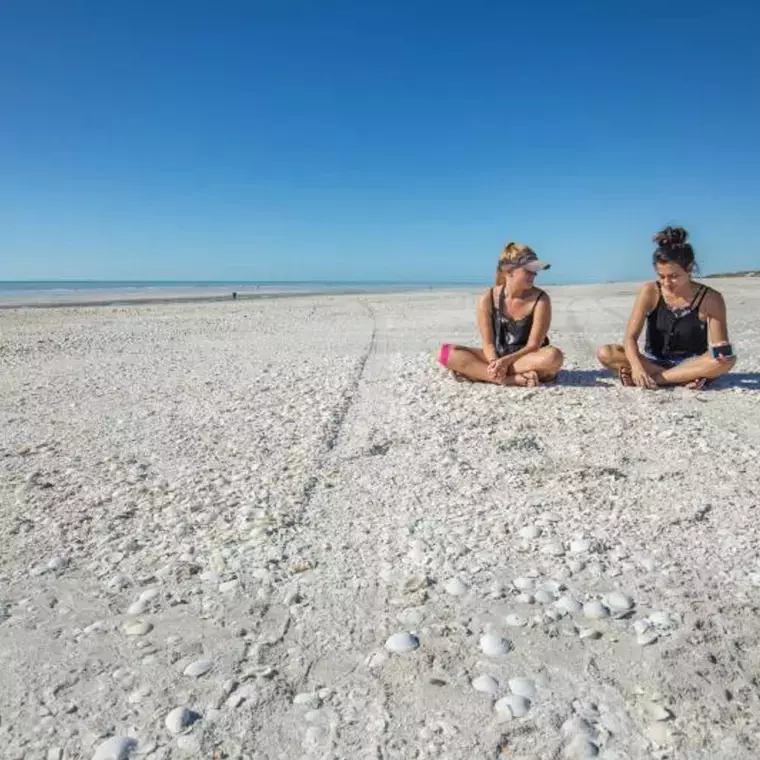
The morning is for walking. In Kalbarri National Park the Murchison River has cut a gorge 80 km long through red and white banded sandstone about 400 million years old. Nature's Window is a natural rock arch framing the river below, and at Z-Bend the gorge doubles back on itself in a tight zigzag. The Kalbarri Skywalk, opened in 2020, pushes two platforms out beyond the rim, 100 metres above the water. Later you head north into Shark Bay. Shell Beach is made not of sand but of billions of tiny cockle shells, piled up to 10 metres deep. It sits in the Shark Bay World Heritage Area, listed in 1991. The road passes Denham, the westernmost town in Australia, on the way to the beach at Monkey Mia.
Overnight: Monkey Mia (hostel)
DAY 3: MONKEY MIA TO CORAL BAY
Start the day on the beach. At Monkey Mia wild bottlenose dolphins have been swimming into the shallows to meet people since the 1960s, and rangers now run the morning visit so it stays good for the dolphins. At Hamelin Pool, where the water is about twice as salty as the open sea, the stromatolites are rock-like mounds built by microbes, a form of life that goes back about 3.5 billion years. Then it's a long run north through Carnarvon, where banana plantations line the Gascoyne River, a river that flows underground most of the year, and over the Tropic of Capricorn to Coral Bay.
Overnight: Coral Bay (hostel)
DAY 4: CORAL BAY AND NINGALOO REEF
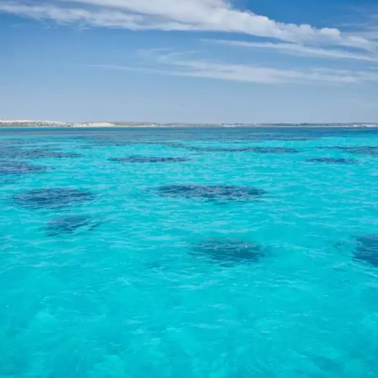
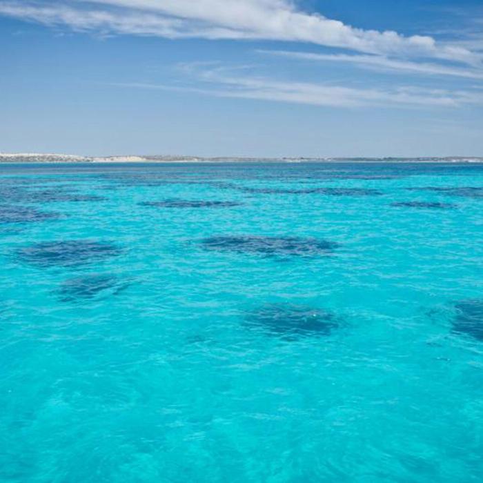
Ningaloo Reef runs 260 km along the coast, World Heritage-listed since 2011, and at Coral Bay the coral starts a few steps from the beach, so you can snorkel straight off the sand. Bring your mask and fins, or hire them in the village. For an extra cost you can join a half-day snorkel with manta rays, which feed off Coral Bay all year, go whale watching in season (humpbacks pass from about June to November), ride a glass-bottom boat or take a scenic flight over the reef. Later in the day you carry on up the cape to Exmouth.
Overnight: Exmouth (hostel)
DAY 5: EXMOUTH AND CAPE RANGE NATIONAL PARK
The morning is for snorkelling off the beach in Cape Range. Cape Range National Park is limestone range on one side and reef on the other. At Turquoise Bay a gentle current carries snorkellers along over the coral, and the Vlamingh Head Lighthouse of 1912, named after the Dutch navigator who passed in 1697, gives the best view up and down the cape. Between about March and July, you can also, at extra cost, swim with whale sharks, the biggest fish in the sea, which gather off Ningaloo every year. Exmouth itself was built in 1967 to support a naval communications station.
Overnight: Exmouth (hostel)
DAY 6: INTO THE PILBARA AND KARIJINI
Today is a big one: about nine hours and 750 km inland, from reef to red rock. The coastal plain gives way to the ranges of the Pilbara, one of the oldest landscapes on earth, and to iron ore country. You pass Tom Price, at 747 metres the highest town in Western Australia, before reaching camp in the Hamersley Range. Karijini National Park in the Hamersley Range is Western Australia's second-largest national park, and its gorges are cut through banded iron rock about 2.5 billion years old.
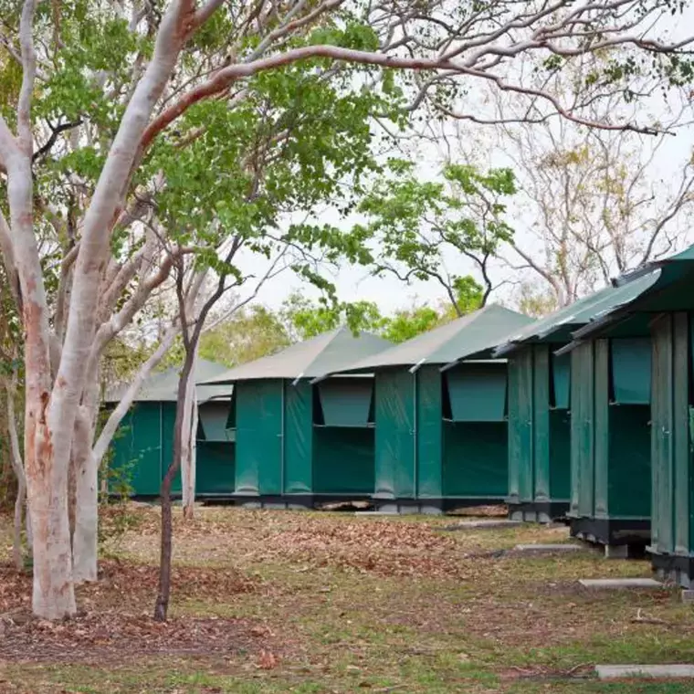
Overnight: Karijini (camping)
DAY 7: THE GORGES OF KARIJINI
In Dales Gorge, Fortescue Falls is the park's only waterfall that runs all year, stepping down terraces of red rock. A short walk upstream is Fern Pool (Jubura), a sacred place to the Banyjima, Kurrama and Innawonga people, where you swim quietly under the ferns. At Oxers Lookout, four gorges meet a hundred metres below your feet. Then come Weano Gorge and Hancock Gorge, where you edge along the Spider Walk, hands and feet on both walls, to reach Kermits Pool. Expect wet feet and cold water.
Overnight: Karijini (camping)
DAY 8: MORE OF KARIJINI
A second full day in the park means time to go deeper. Your guide picks the gorges, swims and lookouts on the day, depending on what's open, how the water is and how the group is feeling. The gorge walls are layered like a stack of red and blue-grey pages, iron laid down on the floor of an ancient sea, and in the evenings the spinifex and white-trunked snappy gums glow in the last light. Look for rock wallabies on the cliffs and the big red Pilbara termite mounds by the road.
Overnight: Karijini (camping)
DAY 9: KARIJINI TO PORT HEDLAND AND A PILBARA STATION
Leave the gorges and head north to the coast at Port Hedland, one of the biggest bulk export ports in the world, where iron ore trains more than 2 km long roll in from the mines and ships the size of city blocks wait offshore. After a quick look around town, it's on to a cattle station in the Pilbara for the night, with the outback dark and quiet around you.
Overnight: Pilbara station (camping)
DAY 10: EIGHTY MILE BEACH TO BROOME
Stop for a walk on Eighty Mile Beach, which is actually about 220 km long. It's one of the most important places in the world for migrating shorebirds, which fly here from as far as Siberia. Then you follow the edge of the Great Sandy Desert north to Broome, in time to watch the sun set into the Indian Ocean. This version of the trip includes your Broome accommodation.
Overnight: Broome
DAYS 11 TO 14: FREE DAYS IN BROOME
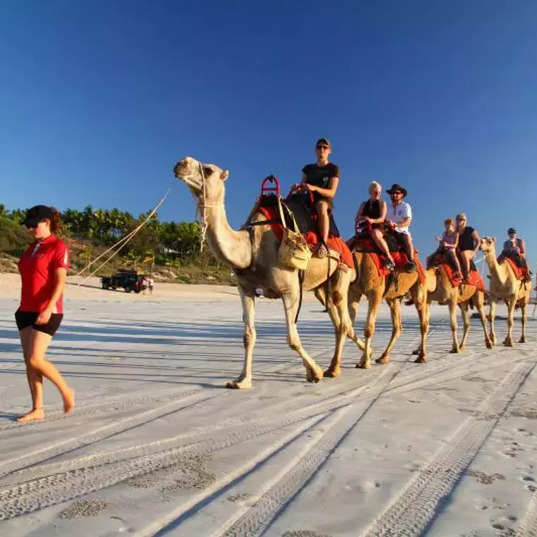
Four days off the bus to do Broome your way. Broome grew up in the 1880s as the pearling capital of the world, and its Japanese cemetery holds more than 900 graves of pearl divers. Cable Beach runs 22 km, and camel trains walk it at sunset. You can ride a camel at sunset or learn the pearling story at a pearl farm. If you're here around a full moon between March and October, watch the Staircase to the Moon, the moonlight laddering across the mudflats of Roebuck Bay. Meals and activities are yours to choose.
Overnight: Broome
DAY 15: BROOME TO TUNNEL CREEK
Back on the road, east towards the Kimberley across the Fitzroy River, whose wet-season floods are among the biggest in Australia. Tunnel Creek (Dimalurru) runs about 750 metres right through the Napier Range, part of a reef that grew in a tropical sea about 350 million years ago. You wade through cool water in the dark, under roosting bats, with a torch. This is where the Bunuba resistance fighter Jandamarra hid from police in the 1890s.
Overnight: West Kimberley (camping)
DAY 16: WINDJANA GORGE AND BELL GORGE
Windjana Gorge has walls up to 100 metres high, part of the same ancient reef, with fossil fish in the rock. Freshwater crocodiles bask on the sand along the Lennard River; they're shy, but keep your distance. Then you join the Gibb River Road and climb into the King Leopold Ranges. At Bell Gorge the creek drops over a series of rock steps into a deep pool, one of the best swims on the Gibb. It opens only when conditions allow, so your guide confirms on the day.
Overnight: Mount Barnett area (camping)
DAY 17: MANNING GORGE AND GALVANS GORGE
At Manning Gorge, by Mount Barnett Roadhouse, the walk starts with a swim or float across the river, then crosses open country to a waterfall and a pool deep enough to jump into. Galvans Gorge is small and shaded, with a boab growing above the falls and a Wandjina figure painted on the rock. The Mount Barnett country around them is run by the Kupungarri community, and camp tonight is close by again.
Overnight: Mount Barnett (camping)
DAY 18: THE GIBB RIVER ROAD TO KUNUNURRA
The longest stretch of the Gibb today, about 600 km and eight hours. The Gibb River Road runs about 660 km across the Kimberley, built in the 1960s to truck cattle to port. Corrugations, river crossings and red dust are part of the deal. At the Pentecost River crossing, the cliffs of the Cockburn Range rise straight behind the water, the most photographed view on the road. By evening you reach a private camp on the Ord River near Kununurra.
Overnight: Near Kununurra, on the Ord River (camping)
DAY 19: INTO PURNULULU AND ECHIDNA CHASM
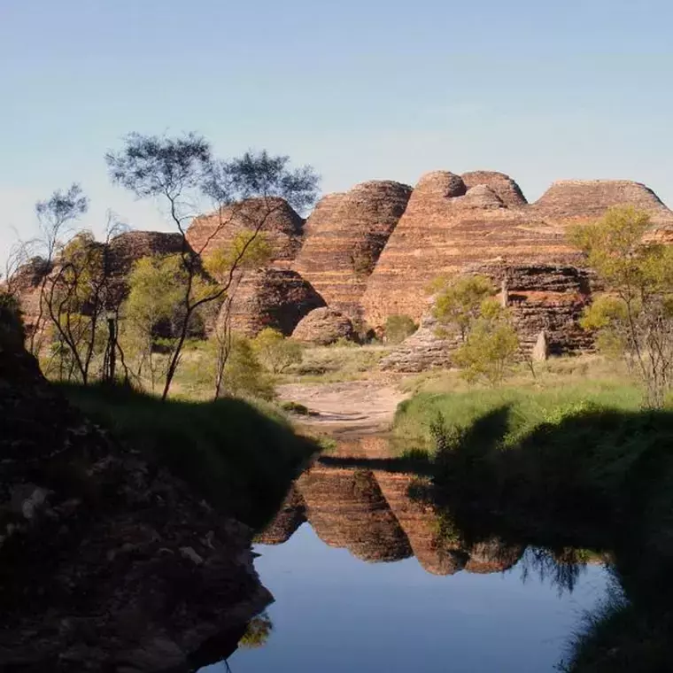
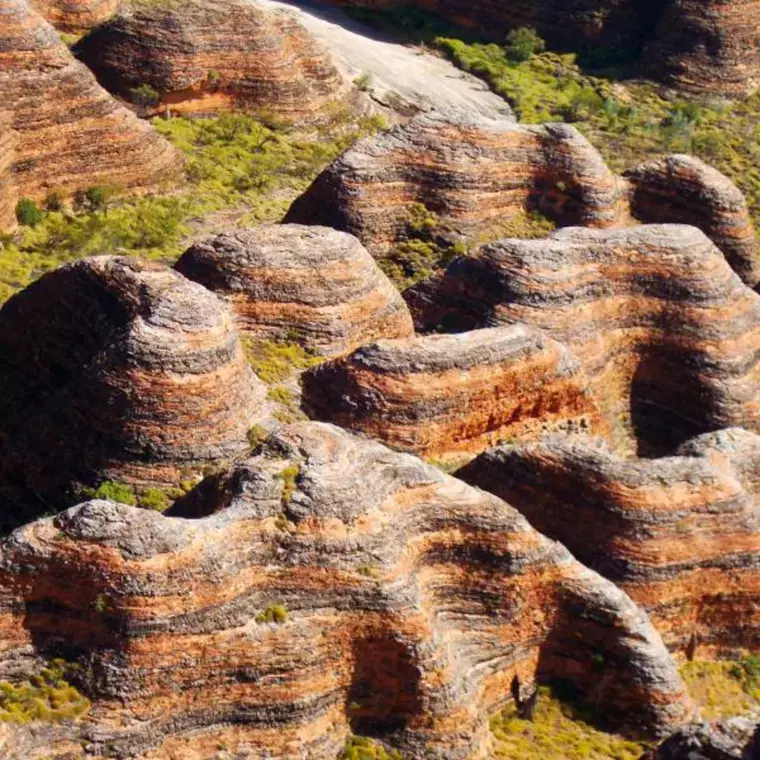
Head south past the Carr Boyd Ranges and the Durack Ranges, named after the pioneering Durack family who drove cattle here in the 1880s, then turn off for the slow 4WD track into Purnululu. Purnululu National Park was hardly known outside the Kimberley until the 1980s and became World Heritage-listed in 2003. Its Bungle Bungle domes are striped orange and black, the orange from iron oxide and the black from cyanobacteria living in the layers that hold more water. Echidna Chasm is a crack in the conglomerate rock, in places less than a metre wide, with walls up to 180 metres high that glow orange when the midday sun reaches the bottom.
Overnight: Bush camp near Purnululu (basic, no showers)
DAY 20: THE BEEHIVE DOMES AND CATHEDRAL GORGE
A full day among the domes. The walk to Cathedral Gorge follows a creek bed between the domes to a huge curved amphitheatre with a pool at its foot, so big and quiet it carries a whisper. The domes themselves are crumbly sandstone, so the paths stay on the creek beds and nobody climbs them. Want to see the whole range at once? For an extra cost, from around $350, a helicopter flight shows you hundreds of domes in one sweep, the way the world first saw them in aerial film.
Overnight: Bush camp near Purnululu (basic, no showers)
DAY 21: EL QUESTRO AND EMMA GORGE
Back north into the East Kimberley. El Questro Station covers about 280,000 hectares of the East Kimberley. Emma Gorge is a walk of about 1.6 km each way over boulders to a pool under a waterfall, ringed by tall cliffs. After the walk, it's a cool swim beneath the falls before you return to camp on the Ord River.
Overnight: Ord River camp (camping)
DAY 22: KUNUNURRA AND THE ORD
A day around Kununurra. Kununurra was built in the 1960s for the Ord River irrigation scheme, which turned the dry valley green with crops. Mirima National Park, on the edge of town, is called the mini Bungle Bungles for its striped sandstone ridges, and the Hoochery Distillery makes rum from the valley's sugar cane. You walk among Mirima's ridges, and late in the afternoon your guide takes you up to a lookout over the upper Ord for sunset, the river shining between green fields and red ranges.
Overnight: Kununurra area (camping)
DAY 23: LAKE ARGYLE TO KATHERINE
First stop is the lake. Lake Argyle filled after the Ord River dam was finished in 1971, and at normal level it holds about 18 times the water of Sydney Harbour, with islands that were once hilltops. Then you cross the border into the Northern Territory, putting your watch forward, and stop for a soak at Katherine Hot Springs, where the water stays warm all year, before camp on the edge of Nitmiluk.
Overnight: Near Nitmiluk National Park, Katherine (camping)
DAY 24: KATHERINE GORGE OR EDITH FALLS TO DARWIN
One last swim before the city. Nitmiluk National Park belongs to the Jawoyn people, who received it back in 1989. Katherine Gorge is really thirteen gorges cut by the Katherine River, and Edith Falls (Leliyn) has a big swimming pool at the foot of the falls. Your guide chooses between the gorge and the falls on the day. Then it's north up the Stuart Highway to Darwin, rebuilt twice after Japanese bombing in 1942 and Cyclone Tracy in 1974, arriving at about 6pm.
Map




 Pictures / Videos

Reviews